


 Art & Design
 Auto & Vehicles
 Beauty
 Business
 Education
 Entertainment
 Finance
 Food & Drink
 Health & Fitness
 House & Home
 Libraries & Demo
 Lifestyle
 Maps & Navigation
 Medical
 Music & Audio
 Parenting
 Personalization
 Photography
 Productivity
 Shopping
 Social
 Sports
 Tools
Tools Travel & Local
 Video Players
 Weather
 Family


 Altimeter GPS+ (Speedometer)
OS :
Version :4.7.3
Size :30.88Mb
Updated :Sep 18,2021
Developer :Tigran Mkhitaryan
 Ask AI
You can ask
the AI some questions about the app
Here are three topics that users may discuss about this app, turned into questions:
1. How accurate is the GPS tracking in Altimeter GPS Speedometer, especially in low-signal areas?
2. Can you customize the user interface and settings of Altimeter GPS Speedometer to suit your needs?
3. Does Altimeter GPS Speedometer sync data with other fitness apps or platforms, such as Strava or Garmin?
 Ask AI
Pros and Cons from users' feedback
Based on the users' reviews on the App Store, here are three pros and three cons of the Altimeter GPS Speedometer app:
Pros:
1. Accurate readings provided by the app, users appreciate the precision of speed and altitude tracking.
2. User-friendly interface allows for easy navigation and logging of data for analysis.
3. Great companion for outdoor enthusiasts, offering valuable insights during hiking, climbing, or biking.
Cons:
1. Some users experience issues with GPS signal loss while using the app, causing incomplete data.
2. Limited compatibility with older Apple devices, leading to disappointment for those with older models.
3. Occasional battery drain observed by users, potentially affecting device performance and lifespan.
App
Downloads
<
>

App
Survey
-
The degree of memory and power consumption Does it affect the experience?
-
Does the update frequency of the application affect the experience?
-
Which of the following elements are very important to the mobile app experience?
-
Whether the app response speed affects the experience?
Description
-------------------- FREE FOR LIMITED TIME -------------------------
Optimized for iPhone 5,5S , iPhone 6, iPhone 6 Plus. iPhone 6S .6S Plus iPhone SE iPhone 7. 7+, iPhone 8.8+, iPhone X
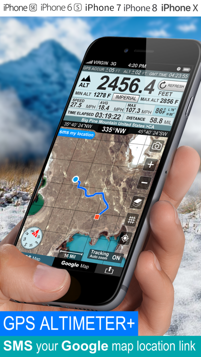
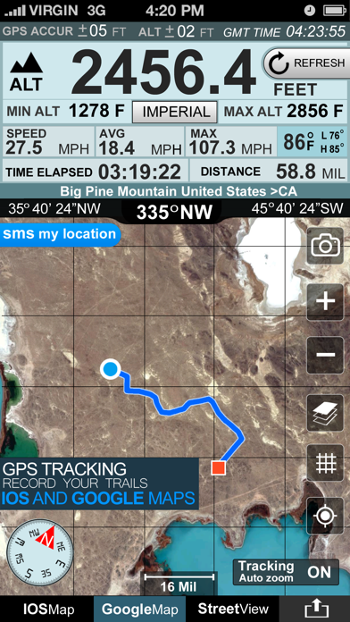
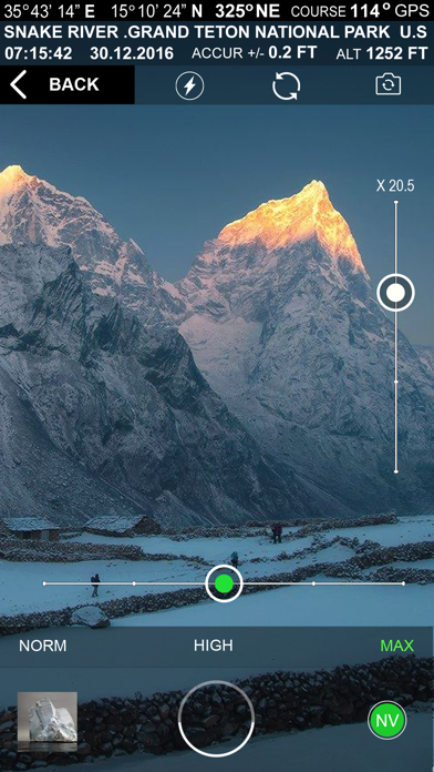
Get your elevation, climb rate and much more, wherever you are !
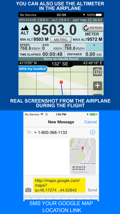
You can also use altimeter in the airplane.
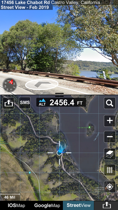
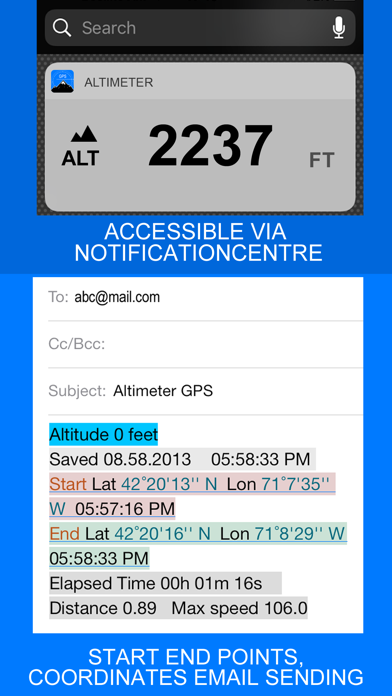
SMS your map location link
Your location link is very helpful in sometimes,such like when you are lost and you want ask your friends for a help. For this situation, you just need send your location link to she/he, and your friend can find you and your ways very easily in the building Maps (for map view in a web browser).
Features included
- Imperial and Metric unit settings.
- Altiude calibrate refresh button.
- GPS accuracy indicator.
- GPS distance accuracy indicator.
Track information
- Time elapsed.
- Distance.
- Average speed.
- Max speed.
- Altitude.
Tracking
- Speed tracking in mph or km/h based on MPH or KM/H mode.
- Distance tracking in miles or kilometers based on MPH or KM/H mode.
- Time tracking.
- Tracking location on map.
- Ability to turn tracking off/on.
- Longitude, latitude coordinates.
Map integration
- Satellite maps mode.
- Hybrid maps mode.
- Standard maps mode.
- Tracking location changes trajectory.
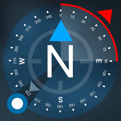
Compass
- Shows device real-time orientation to magnetic fields.
- Ability to switch between true and magnetic North.
- Location coordinates (longitude, latitude).
- Course
Share
- Start, end points, coordinates link email sending
- Map screenshot email sending
{{descriptionMoreText}}
Comments (0)
{{commentText.length}}/{{maxCommentText}}
{{commentError}}{{commentUserError}}
-
{{comment.commentUser.substring(0, 1)}}By {{comment.commentUser}}{{comment.commentDateString}}


Category Top
apps
- Google Play
- App Store


More Apps


