


 Art & Design
 Auto & Vehicles
 Beauty
 Business
 Education
 Entertainment
 Finance
 Food & Drink
 Health & Fitness
 House & Home
 Libraries & Demo
 Lifestyle
 Maps & Navigation
 Medical
 Music & Audio
 Parenting
 Personalization
 Photography
 Productivity
 Shopping
 Social
 Sports
 Tools
Tools Travel & Local
 Video Players
 Weather
 Family


 i-Hunting : GPS Maps App
OS :
Version :101.0.0
Size :55.16Mb
Updated :May 24,2021
Developer :Bist LLC
 Ask AI
 Ask AI
Pros and Cons from users' feedback
Based on the users' reviews of the I Hunting GPS Maps app, here are the pros and cons in English, with 15 words limited for each item:
2User-friendly interface and intuitive design make it easy to use for beginners.
3Large selection of hunting maps and territories covered, including public and private lands.
2Limited customer support and responsiveness to user concerns and feedback.
3Weather forecasting feature lacks accuracy, leading to disappointment and inconvenience.
Pros:
1Accurate GPS navigation and mapping feature helps users navigate through wilderness.2User-friendly interface and intuitive design make it easy to use for beginners.
3Large selection of hunting maps and territories covered, including public and private lands.
Cons:
1Some users report glitches and app crashes, causing frustration and lost sessions.2Limited customer support and responsiveness to user concerns and feedback.
3Weather forecasting feature lacks accuracy, leading to disappointment and inconvenience.
Based on the users' reviews of the "I Hunting GPS Maps" app, here are the pros and cons in English, with 15 words limited for each item:
**Pros:**
1. Accurate GPS navigation and mapping feature helps users navigate through wilderness.
2. User-friendly interface and intuitive design make it easy to use for beginners.
3. Large selection of hunting maps and territories covered, including public and private lands.
**Cons:**
1. Some users report glitches and app crashes, causing frustration and lost sessions.
2. Limited customer support and responsiveness to user concerns and feedback.
3. Weather forecasting feature lacks accuracy, leading to disappointment and inconvenience.
App
Downloads
>

App
Survey
- Whether the app response speed affects the experience?
- The degree of memory and power consumption Does it affect the experience?
- What is the number of APPs on your phone?
- Where do you get the new APP
Description
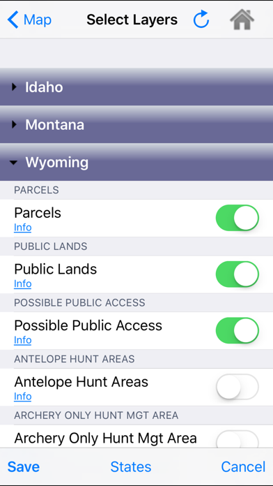
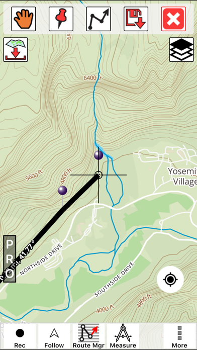
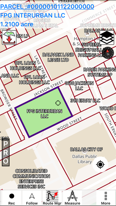
This hunting GPS app provides access to property line maps, parcels & public
lands, land ownership details. Map layers for 50+ states include hunting
zones, restricted areas, possible access areas, state refgues and more.
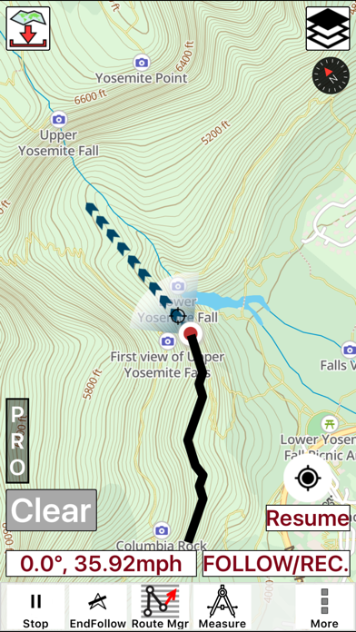
Vector topo maps with most accurate USGS elevation contours, hiking & biking
trails. Coverage includes all US states.
► Vector Topo Maps
√ Beautiful & detailed Hardware/GPU accelerated vector maps (text stays upright on rotation)
√ Vector USGS contours (Change height to ft or meter).
√ Covers popular hiking & biking trails and paths
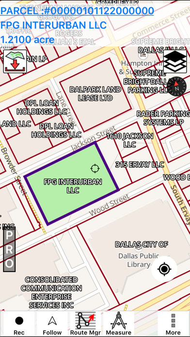
► Parcel Maps
√ Includes following ownerhsip attributes (where available)
* Owner name and Owner address
* Site Address
* Parcel ID Total Value
► Hunt Planning maps
√ Possible Public Access
√ Public lands and Parcels
√ Hunting Zones
√ Game Distribution
√ Restricted Ares
√ Portions
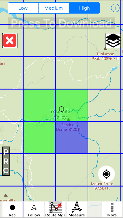
► Offline vector maps
√ Easy to download offline topos
► PLSS maps
√ PLSS Townships and Sections (US Wide coverage)
► Custom base maps
√ Switch base maps between vector topos, hybrid satellite imagery and more
►GPS FEATURES
√ Record Tracks
√ Enter or import Waypoints.
√ Auto Follow
* Real Time Track Overlay
* Predicted Path Vector
* Course Up(Text stays upright)
* Speed & Heading
√ Route Assistance With Voice Prompts
* Prompts when approaching a boating route marker
* Continous distance & ETA updates
* Alerts when off route
* Alerts when moving in wrong direction
►ROUTE MANAGEMENT / TRIP PLANNING
√ Create New Route/Edit Existing Routes
√ Move Points
√ Add points to an existing route leg
√ Delete / Rename points
√ Import GPX,KML & KMZ files
√ Plot/Edit Routes
√ Enter Waypoints
√ Share/Export Routes,Tracks&Markers
√ Reverse Routes
►Solunar Forecast
* Sun Rise, Sun Set
* Moon Rise, Moon Set, Moon Transit, Moon Phase
* Major & Minor activity times
* Day Scale
► SHARING
* Share tracks/routes/markers on Facebook & Twitter
* Export tracks/routes/markers as compressed GPX files.
Comments (2)
0/255
- MBy Manaw VickyApr 30,2020
- jBy jason ben AlexaAug 11,2018
- <
- 1
- >
Developer apps

Category Top
apps
- Google Play
- App Store


More Apps


