


 Art & Design
 Auto & Vehicles
 Beauty
 Business
 Education
 Entertainment
 Finance
 Food & Drink
 Health & Fitness
 House & Home
 Libraries & Demo
 Lifestyle
 Maps & Navigation
 Medical
 Music & Audio
 Parenting
 Personalization
 Photography
 Productivity
 Shopping
 Social
 Sports
 Tools
Tools Travel & Local
 Video Players
 Weather
 Family


 World atlas & map MxGeo Pro
OS :
Version :8.7.2
Size :231.17Mb
Updated :Oct 16,2022
Developer :Hans-Peter Bahn
 Ask AI
You can ask
the AI some questions about the app
Here are three topics that users may discuss about the World Atlas Map MXGeo Pro app, turned into questions for you:
1. What features do you like most about the app's offline map functionality?
2. How does the app's GPS navigation compare to other mapping apps you've used?
3. Are you satisfied with the app's accuracy in displaying geographical boundaries and landmarks?
 Ask AI
Pros and Cons from users' feedback
I'd be happy to help you with that! After analyzing the user reviews on the Apple App Store, here are three pros and three cons of the World Atlas Map MXGeo Pro app:
Pros:
1. Accurate and detailed maps with precise location tracking, making navigation easy.
2. User-friendly interface with clear labels and zooming capabilities for easy exploration.
3. Regular updates with new features and improved performance, ensuring a seamless experience.
Cons:
1. Some users find the app's data outdated, lacking recent changes and updates.
2. Limited offline access, requiring a stable internet connection for most features.
3. Occasional crashes and glitches, causing frustration and lost data.
Please let me know if you'd like me to elaborate on any of these points or if you have any further questions!
App
Downloads
<
>


App
Survey
-
The degree of memory and power consumption Does it affect the experience?
-
How much traffic the app consumes Does it affect the experience?
-
What is the number of APPs on your phone?
-
Whether the application ad recommendation affects the experience?
Description
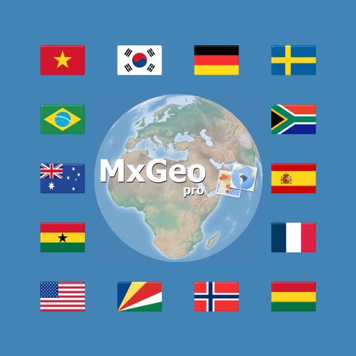
World atlas, world map and educational app for geography. Contains over 260 countries and territories of the world with comprehensive economic and geopolitical data. Political maps with regional units (provinces), capitals and major cities included.
• Maps, flags and comprehensive data for over 260 countries and territories of the world
• Interactive political world, continent and country maps
• Shaded relief layer for world and continent maps
• Historical political world and continent maps of 1900, 1930 and 1960
• Geography quiz: capitals, flags, federal states, ...
• Country comparison, favorites and distance calculator
• Print maps and country data
• World-explorer: the smallest, largest, wealthiest, and most populated countries of the world
• World Explorer: largest cities, longest rivers and highest mountains
• Choropleth maps: temperature, area, HDI, population, ...
• Search for countries, major cities, rivers, deserts, lakes, mountains or coordinates
Explore the world by political continent and country offline maps. Whether Europe, Africa, Asia, Oceania, South and North America: maps of all continents and countries are included. Learn where each country in the world is located. View its position highlighted on a digital globe. Create your favorite color theme or choose from different color schemes for map display.
Do you know the flag of Mauritius? Yes? Perfect. Do you also know in which country Mount Everest is located?
Increase your general geography knowledge in a playful manner. MxGeo Quiz: test your geographic literacy on various topics:
• Do you know the longest rivers on Earth?
• Federal states / provinces for selected countries
• Test your knowledge about the capitals in the world
• Recognize the proper country flag based on the outline map
• Do you know the top-level domains of the world's countries
• Guess the highlighted country on the virtual globe
• Guess the right country by the flag
• Do you know the ISO countries codes of the world?
• Do you know the mountains of the world?
Each quiz offers seven regional variants: World, Europe, Africa, Asia, Oceania, South or North America.
Geo learning app and educational game which is fun for everyone whether children, adults, seniors or teachers. Get ready for your next stay abroad while enjoying this great world almanac including time zones and statistical data, such as population growth, unemployment rate, average age, gross domestic product (GDP) by sector and other key figures. Or prepare for your next geography lesson with this genius digital world map. If not traveling our world atlas lets you explore the world just only virtually.
Enjoy this comprehensive atlas of the World including Europe, Asia, North America, Africa, Oceania and South America with all countries and regional units, capitals and flags.
{{descriptionMoreText}}
Comments (0)
{{commentText.length}}/{{maxCommentText}}
{{commentError}}{{commentUserError}}
-
{{comment.commentUser.substring(0, 1)}}By {{comment.commentUser}}{{comment.commentDateString}}
Category Top
apps
- Google Play
- App Store


More Apps


