


 Art & Design
 Auto & Vehicles
 Beauty
 Business
 Education
 Entertainment
 Finance
 Food & Drink
 Health & Fitness
 House & Home
 Libraries & Demo
 Lifestyle
 Maps & Navigation
 Medical
 Music & Audio
 Parenting
 Personalization
 Photography
 Productivity
 Shopping
 Social
 Sports
 Tools
Tools Travel & Local
 Video Players
 Weather
 Family


 World History Maps: Ancient
OS :
Version :3.0
Size :81.50Mb
Updated :Jun 14,2020
Developer :WORLD HISTORY MAPS INC.
 Ask AI
You can ask
the AI some questions about the app
Here are three potential topics that users may discuss about the World History Maps - Ancient app, turned into questions for you:
1. What features do you think are most useful for understanding ancient civilizations in the app's map view?
2. How do you plan to use the app's timeline feature to explore historical events and their connections?
3. What kind of historical content or events are you most excited to explore using the app's interactive maps and 3D models?
 Ask AI
Pros and Cons from users' feedback
I'd be happy to help you with that! After analyzing the user reviews on the Apple App Store, here are three pros and three cons of the World History Maps - Ancient app:
2Maps are detailed and easy to navigate, perfect for exploring ancient civilizations.
3App is well-designed and user-friendly, making it accessible to a wide range of users.
2Limited content and lack of updates, making it feel like a static resource rather than a dynamic app.
3Occasional crashes and glitches, which can disrupt the learning experience and be
Pros:
1Engaging and interactive way to learn ancient history, great for students and history buffs alike.2Maps are detailed and easy to navigate, perfect for exploring ancient civilizations.
3App is well-designed and user-friendly, making it accessible to a wide range of users.
Cons:
1Some maps are outdated or missing, which can be frustrating for those looking for specific information.2Limited content and lack of updates, making it feel like a static resource rather than a dynamic app.
3Occasional crashes and glitches, which can disrupt the learning experience and be
I'd be happy to help you with that! After analyzing the user reviews on the Apple App Store, here are three pros and three cons of the "World History Maps - Ancient" app:
Pros:
1. "Engaging and interactive way to learn ancient history, great for students and history buffs alike."
2. "Maps are detailed and easy to navigate, perfect for exploring ancient civilizations."
3. "App is well-designed and user-friendly, making it accessible to a wide range of users."
Cons:
1. "Some maps are outdated or missing, which can be frustrating for those looking for specific information."
2. "Limited content and lack of updates, making it feel like a static resource rather than a dynamic app."
3. "Occasional crashes and glitches, which can disrupt the learning experience and be
App
Downloads
>


App
Survey
- What is the number of APPs on your phone?
- Do you think the payment of application features affects the experience?
- Do you think the stability of the application affects the experience?
- Where do you get the new APP
Description
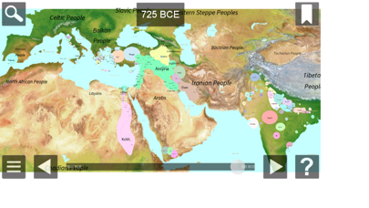
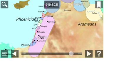
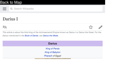
This interactive atlas of the ancient western world gives you a close up view of the area from the Mediterranean to India from 3000 BCE to 500 BCE. The map allows zooming and panning. Pop-up information is available for each country shown. Each map shows all countries of the world as they were at the beginning of each year. View cities, battles, campaigns, ancient roads, and more. Links to Wikipedia articles provide more detail. Zoom in without losing any detail.
Comments (0)
0/255
Category Top
apps
- Google Play
- App Store


More Apps


